
Our goal behind our Rec Resources page is to help you get out on the water but know the sections listed here are not a complete list and we recommend good river maps like the River Rat Maps. We sell maps for most of the rivers around the state!
River Flows | Breakdown of Local Rivers | Montana River Permits | Day Floats | Overnight/Multiday Floats | Whitewater | Surf Spots | Shuttle Services
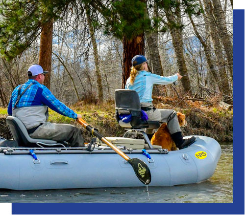
Blackfoot River
- Harry Morgan to River Junction 2.2 mi
- River Junction to Russell Gates 12.4 mi
- Russell Gates to Roundup 11 mi
- Roundup to Riverbend 6.7 mi
- Riverbend to Whitaker Bridge 3.7 mi
- Whitaker Bridge to Johnsrud Park 6.1 mi
- Johnsrud Park to Wisherd Bridge 6.2 mi
- Wisherd Bridge to Weigh Station 4.6 mi
- Weigh Station to Confluence 2 mi
Clark Fork
- Schwartz Creek to Turah 8.2 mi
- Turah to Sha-ron 8.4 mi
- Sha-ron to McCormick Park 4.7 mi
- McCormick Park to Confluence of Bitterroot 6.7 mi
- Kelley Island (Mullan Rd) to Kona Bridge 4. mi
- Kona Bridge to Harper’s Bridge 4.9 mi
- Harper’s Bridge to Single Tree 7.5 mi
- Single Tree to Petty Creek 14.1 mi
- Petty Creek to St Johns (rest stop) 5.2 mi
- St Johns to Cyr 2.7 mi
- Cyr to Tarkio 9.7 mi
- Tarkio to Forest Grove 5.2 mi
- Forest Grove to Big Eddy 12 mi
- Big Eddy to Sloway 8.6 mi
- Sloway to St Regis 6.4 mi
Bitterroot sections
- Hannon Memorial to Darby Bridge 3.8 mi
- Darby Bridge to Wally Crawford 6.5 mi
- Wally Crawford to Angler’s Roost 9.7 mi
- Angler’s Roost to Veterans Bridge 6.6 mi
- Veterans Bridge to Woodside Bridge 3.1 mi
- Woodside Bridge to West Tucker 5 mi
- West Tucker to Bell Crossing 6.5 mi
- Bell Crossing to Stevi Bridge 7.1 mi
- Stevi Bridge to Florence Bridge 10.5 mi
- Florence Bridge to Lolo 12 mi
- Lolo to confluence 10.3 mi
Rock Creek
- Confluence to Gilles (now know as Kyle Bohenson memorial Bridge) 8.7 miles
- Gilles to Windlass Bridge (aka concrete bridge) 6.1 miles. Below this point, the river is permitted for commercial use by the forest service.
- Below the Windlass Bridge there are nearly 35 access points floaters use so stretches vary widely as do the ease of access, most are steep and challenging to use especially at higher flows. There can be river wide obstructions nearly everywhere but the stretch from mile 24 to mile 26 wood debris is very common.
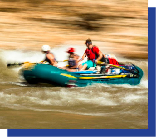
- There is also the white water stretch from Harrys Flat to what is labeled as Camp 2 or down to Lower Fire Ring, Whitewater at higher flows can be technical and 11+ to III.
- People die on Rock Creek regularly because boater focus is fishing. There are an extraordinarily large number of floaters that do not wear a PFD.
- Smith River – The Smith River features an incredible 59-mile stretch of river with only one put-in and one take-out point. Due to the demand for floating use and the need to manage the resource and recreational experience, a limited number of float permits are issued. The application for the Smith River permit is due each year in mid-February.
http://stateparks.mt.gov/smith-river/
- Upper Bitterroot and West Fork Bitterroot River – A permit is required for commercial fishing and floating on the West Fork of the Bitterroot and a portion of the upper Bitterroot (Hannon Memorial FAS to Wally Crawford FAS). There is no permit required of the general recreating public but there are special angling and boating restrictions that apply to nonresidents and commercial outfitters. Call (406) 542-5564for more information.
http://fwp.mt.gov/recreation/permits/floating/bitterroot.html
- Madison River – If you are organizing a competitive event or plan to recreate in a group of 15 or more on the Madison River and adjacent public lands, a Special Recreation Permit is required.
http://fwp.mt.gov/recreation/permits/floating/madison.html
- Blackfoot River – Commercial use, organized group events and competitive events on the Blackfoot River require a Special Recreation Permit. All persons sponsoring or conducting commercial uses and competitive events requiring a special recreation permit should apply to FWP at least 60 days before the use is intended. All persons sponsoring or conducting an organized group activity should contact FWP at least 30 days before the activity is intended to begin.
http://fwp.mt.gov/recreation/permits/floating/blackfoot.html
- Alberton Gorge – A permit is required to conduct commercial use on the Alberton Gorge of the Clark Fork River. Contact the FWP Region 2 office in Missoula for more information (406) 542-5562.
- Beaverhead and Big Hole Rivers – A permit is required to conduct commercial use on the Beaverhead and Big Hole rivers. Contact the FWP Region 3 office in Bozeman for more information (406-994-3552). There is no permit required of the general recreating public but there are special angling and boating restrictions that apply to nonresidents and commercial outfitters.
http://fwp.mt.gov/recreation/permits/floating/beaverheadBigHole.html
Clark Fork River: Brennan’s Wave
From Missoula: 0 miles away
Difficulty: Medium
Clark Fork River: Sha-ron to McCormick Park
From Missoula: 3.6 miles away
Difficulty: Easy
French Town Pond
From Missoula: 17.5 miles away
Difficulty: Easy
Blackfoot River
From Missoula: 18.9 miles away
Difficulty: Medium
Blackfoot River: Whittaker Bridge to Johnsrud
From Missoula: 23.7 miles away
Difficulty: Medium
Clark Fork River: Alberton Gorge
From Missoula: 37.5 miles away
Difficulty: Hard
Clark Fork River: Alberton Gorge Triple Bridges
From Missoula: 38 miles away
Difficulty: Hard
Harpers Lake
From Missoula: 40.6 miles away
Difficulty: Easy
Canoe Trail: Clearwater River to Seeley Lake Ranger Station
From Missoula: 56.7 miles away
Difficulty: Easy
Lochsa River, Idaho
From Missoula: 97.6 miles away
Difficulty: Expert
Blackfoot River
18.9 miles away
Difficulty: Medium
Clark Fork River: Superior to St. Regis
68.5 miles away
Difficulty: Easy
Flathead River: Buffalo Bridge to Sloan Bridge
75.6 miles away
Difficulty: Easy
Missouri River: Holter Dam to Cascade or Ulm
130 miles away
Difficulty: Easy
Northfork Flathead River
181 miles away
Difficulty: Medium
Missouri River Fort Benton to Judith Landing
207 miles away
Difficulty: Easy
Missouri River: Judith Landing to Robinson Bridge
300 miles away
Difficulty: Easy
Yellowstone River
399 miles away
Difficulty: Easy
Clark Fork River: Brennan’s Wave
0 miles away
Difficulty: Medium
Blackfoot River
18.9 miles away
Difficulty: Medium
Yellowstone River
399 miles away
Difficulty: Easy
Clark Fork River: Alberton Gorge
37.5 miles away
Difficulty: Hard
Clark Fork River: Alberton Gorge Triple Bridges
38 miles away
Difficulty: Hard
Lochsa River, Idaho
97.6 miles away
Difficulty: Expert
Clark Fork River: Brennan’s Wave
0 miles away
Difficulty: Medium
Blackfoot River: The Ledge
19 miles away
Difficulty: Medium
Clark Fork River: Alberton Gorge Triple Bridges
38 miles away
Difficulty: Hard
Blackfoot
Tommy Boyle 406-370-5845
Blackfoot River Shuttle
Bitterroot
Pat Ellis 406-370-2949
Clearwater Shuttle
Whittaker Bridge and downstream 406-381-1265
Four Rivers Shuttle
Lower Clark Fork
Sonjas 406-822-4358
Ovando River Shuttles
Home 406-793-2568 or Cell 406-210-2795
Rock Creek Shuttle
Right Turn Clyde Shuttles 406-240-5455
Flathead River, Buffalo to Perma