Clark’s Fork of the Columbia (Clark Fork)

Running through Missoula Valley is the Clark’s Fork of the Columbia, named by Lewis and Clark in April of 1805.  We have shortened that to simply the Clark Fork as it is referred to today.  This river drains a very large swath of Western Montana. Running over 310 miles, it drains more water from Montana than any other river.  The head waters begin high up in Deer Lodge County on the flanks of Mt. Evans at 10,642’. Fishable water begins around the confluence of Silver Bow Creek at Warm Springs. Fishing is marginal as the course of the river slowly winds down through the valley on its westerly course. Warm water and sedimentation keep fish counts very low in the upper stretches of the river.  In addition the 100 plus years of mining activity had a negative impact on the river that is slowly being remediated from the top down.   The river picks up several large creeks as it flows west each one adding some needed cool clean water and slowly improving the fishery.

The Clark Fork River doesn’t  really become floatable until it picks up the Little Blackfoot River at Garrison Junction. For the next 65 miles the river winds slowly along the highway. This stretch is not popular for floating as the river course closely follows interstate 90 and has a low fish population.

Once the Clark Fork is fed by Rock Creek about 25 miles east of Missoula, the water temperatures cools and fish populations go up dramatically. From the confluence of Rock Creek downriver to St. Regis, the Clark Fork becomes a very popular recreational river. This stretch runs on the bottom of what used to be Glacial Lake Missoula. This section of 110+ miles of the Clark Fork has great fishing floats, relaxing lazy day floats and a stretch of very challenging and popular Class III-IV white water called the Alberton Gorge.

Before the Clark Fork exits Montana to the West, it almost doubles in volume by picking up the Flathead River, flowing in from the North. The confluence of which occurs near Paradise, MT.  From this point, the river is large and slow as it backs up behind several dams and the trout population drops in favor of warmer water species. The Thompson Falls Dam is 34 miles  from the confluence of the Flathead River and then the Noxon Rapids Dam another 37 miles downriver. Shortly after, flows speed up after passing through this dam, they begin to slow almost immediately as they back up behind the Cabinet Gorge Dam just on the Idaho side of the Boarder. This lower Stretch from Paradise to the state line is popular with power and jet boats as there are no motor restrictions. These dams are large and a source of hydroelectric power, so long portages would be required to get past them.

With plentiful wildlife viewing, geologic uniqueness and diverse recreational opportunities, the Clark Fork River is a cherished resource.

Turah Bridge (Flow after Rock Creek Confluence, before Blackfoot)

Clark Fork at Turah Bridge nr Bonner MT

Current Water Level:
Water Level Graph for USGS Station 12334550 Source
Above Missoula (flow after Blackfoot confluence, before Bitterroot)

Clark Fork above Missoula MT

Current Water Level:
Water Level Graph for USGS Station 12340500 Source
Below Missoula (after confluence of Bitterroot)

Clark Fork below Missoula MT

Current Water Level:
Water Level Graph for USGS Station 12353000 Source

Bitterroot River

With its’ headwaters high in the mountains of Ravalli County, the Bitterroot River runs a generally South to North course for about 85 miles before it flows into the Clark Fork River near Missoula.  The native Salish named the river after the plant who’s’ root was a staple food source. Spet-lum, the Salish word meaning  “place of the Bitterroot” was eventually translated by early explorers as the Bitterroot. The East and West Forks of the river system are too small to be floatable most of the time but are floated when conditions warrant.  The west fork is a popular enough fishery to warrant permiting and restrictions for commercial fishing guides.   Both the East and West forks  do offer good wade fishing opportunities. Once the two forks merge near the town of Conner, the Bitterroot starts showing its’ great floatable size, abundant fish populations and stunning scenery. Flowing north through a wide and gentle valley, at the foot of the dramatic and beautiful Bitterroot Mountains, the river offers remarkable floating and fishing.

While it is one of the gentlest gradients of Western Montana’s rivers, it does hold some challenges and hazards to floaters. With a wide riparian valley along the banks, the high runoff and beavers contribute a very steady supply of trees and debris to the river channel. As the river snakes back and forth, that wood is deposited along the way. This wood creates obstructions in the river that often account for more fatalities each year than other Montana rivers west of the Continental Divide. River wide debris and log jams occur each year in the Spring and extreme caution should be used when floating the river in the Spring and early Summer.

With an amazing backdrop of snowcapped peaks, the Bitterroot Rivers offers some of the most beautiful and rewarding recreational and fishing floats in Montana. With many access points, and running quietly through many large ranches and farms, the Bitterroot River is a gem in the crown of Montana.

Darby

Bitterroot River near Darby MT

Current Water Level:
Water Level Graph for USGS Station 12344000 Source
Bell Crossing

Bitterroot River at Bell Crossing nr Victor MT

Current Water Level:
Water Level Graph for USGS Station 12350250 Source
Near Missoula

Bitterroot River near Missoula MT

Current Water Level:
Water Level Graph for USGS Station 12352500 Source

Blackfoot River

The Blackfoot River is one of the best rivers to float in Montana. Combining excellent and diverse scenery with a wide variety of river conditions, any float on the Blackfoot River will lead to a memorable experience. The Blackfoot flows from Anaconda Creek near Rogers Pass 132 miles to the confluence with the Clark Fork River.

Access along the river is excellent. The upper portion of the river frequently flows through public lands but has stretches that are large private ranch lands. The lower portion of the river flows through the Blackfoot River Recreation Corridor. This corridor provides numerous official access sites. Additionally, countless unofficial access sites are available off of Montana Highway 200 and several back roads that parallel the river on the other north side.

The river is generally divided into 7 reaches as the river recreation plan done in 2010 describes:

for specific mileage on each reach take a look at the Rec Resources page of the site, or better yet swing in and grab a River Rat map of the Blackfoot

  • Reach 1 – Headwaters to Mineral Hill Area
  • Reach 2 – Mineral Hill Area to the North Fork Confluence
  • Reach 3 – Harry Morgan FAS to Russell Gates FAS
  • Reach 4 – Russell Gates FAS to Roundup FAS
  • Reach 5 (Upper) – Roundup FAS to Whitaker Bridge
  • Reach 5 (Lower) – Whitaker Bridge to Johnsrud Park FAS
  • Reach 6 – Johnsrud Park FAS to the Clark Fork Confluence
  • Reach 7 – North Fork Blackfoot River (North Fork Falls to Harry Morgan FAS)
More Information

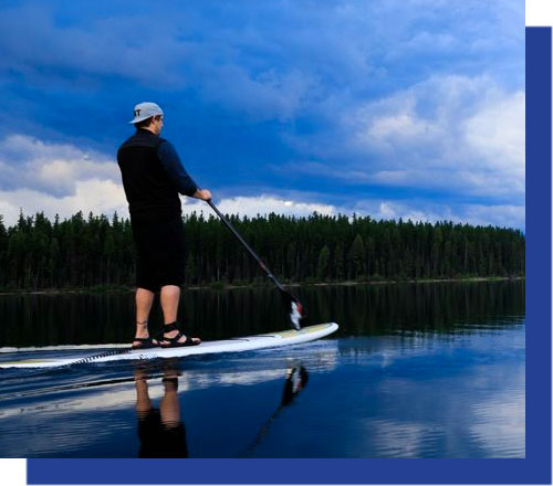
Floating and rafting can begin on the Blackfoot River near the town of Lincoln, more than 110 miles upstream from its confluence with the Clark Fork. Although the lion’s share of the recreation on the river is in  reaches 3,4,5,and 6, which start near Ovando.

The upper portion of the Blackfoot River has primarily slow water. The river is fairly narrow and flows through dense forests. Many logjams can also be found along the river, especially in the vicinity of Nevada Bridge, about 18 miles downstream from Lincoln. Wildlife is abundant along this stretch of the Blackfoot River. This stretch of the Blackfoot is rarely floated due to log jams and long slow stretches.

The Blackfoot River then flows into a wide open valley and through agricultural land and on into a more forested area as it leaves the Ovando valley. The first of the many rapids on the river is encountered several miles above Scotty Brown Bridge in the most popular fishing stretch of the river known as the box Canyon (reach 3). This rapid is short and is easily navigable by rafters and floaters of intermediate skill.

Beginning at Scotty Brown Bridge, the river enters the Blackfoot River Recreation Corridor For the first five miles, the river is marked by a quick flow,  lots of turns, but no whitewater.

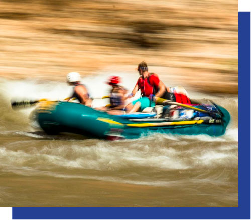
Beginning at Russell Gates, the whitewater section of the Blackfoot River begins. A couple miles below Russell gates you get into what is considered the white water sections of the river (reaches 4 and the upper and lower reach 5). The Blackfoot River has numerous rapids, several of which are Class III. Due to large waves and several small drops, this section of river should not be run in a canoe unless you have whitewater canoe experience. Beginners in rafts should also be wary of running this stretch of the Blackfoot River especially during runoff.  During Higher spring flows the river below Russell Gates to the weigh station is western Montana’s Most Popular whitewater river with lots of private and commercial rafting trips on the water. It is also a classic place that intermediate whitewater Kayakers get to experience whitewater.

This stretch is somewhat visually polluted by the development of the river banks with massive Glamping Sites for the rich and famous on the swanky but visually annoying, Paws Up Guest Ranch.

In the main Blackfoot River Corridor (reaches 3-6) there are additional restrictions to the public’s use,  It is not legal to camp in reaches 4,5, and 6 except in established camp sites. In return the public is able to walk up to 50 feet above the high water mark to make wade fishing easier to navigate. There is a mix of public and private land but the rules apply to both. There are exceptions (especially around the guest ranch) where the public is restricted to the high water marks. Look for signage mounted well below the high water mark telling you to stay away, and of course keep your eyes open for some obnoxious rich Hollywood types who may be eating caviar on the beach.

Below the main whitewater section which ends at Johnsrud park, occasional Class II rapids can be found intermittently down the remainder of the Blackfoot River, but should pose no problems to alert floaters. For those traveling by canoe, it is advisable to scout these rapids before running them, as the severity of the rapids changes greatly with fluctuating water levels.  Low levels expose rocks and can be challenging to maneuver.

The last take out on the river is at The Weigh station just upstream from Bonner. The river between the Weigh Station access and the confluence is still closed at this time while that section is undergoing rehab and clean up. We hope to see it open by 2021.

Near Bonner

Blackfoot River near Bonner MT

Current Water Level:
Water Level Graph for USGS Station 12340000 Source

Rock Creek

Rock Creek begins its’ 52 mile journey from Granite County North along the east side of the Sapphire Mountains to its confluence with the Clark Fork river near the town of Clinton. From the confluence of the East Fork, Middle Fork, West Fork, and the Ross’s Fork near the highway 38 bridge, Rock Creek can be floatable. While this creek has a very short float season, it does offer some spectacular wade fishing and camping opportunities.

Rock Creek is closed to fishing boats after July 1st each year, while technically legal to float and not fish, the impact to wade fisherman will get you a strong condemnation for being on the water in a boat. The early float season is very challenging as Rock Creek road is not paved, snow covered and very narrow. As the weather warms and access by road improves, that’s the time we see high water in the creek and a high number of boats on the water. Rock Creek is most well known for the Salmon Fly hatch that happens generally in Late may through mid June but can be early or late and tends to correspond to the peak flows in the creek.

With a steady gradient and lots of trees and large boulders, floating Rock Creek requires an experienced and strong rower or paddlers. Because of the constant boat maneuvering and challenging features, rafts make up about 90% of the boat usage. Trees and log jams often create impassable blockages, combined with fast flowing and very cold water, extreme caution should be used for the early season floats. This creek is best for experienced boaters and has claimed lives because of simple mistakes like not wearing a PFD!  All precautions should be followed when planning a float on Rock Creek.

Near Clinton

Rock Creek near Clinton MT

Current Water Level:
Water Level Graph for USGS Station 12334510 Source